Student of Non-violent Communication, researcher, trainer.
Calculating Wavefront Propagation Velocity map
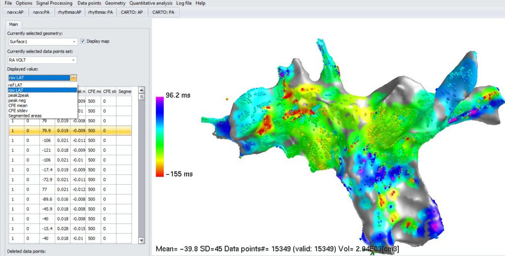
In “Displayed value” selection, select LAT (Local Activation Time) map that should be used as a base for WPV map calculation (e.g. in NavX imported map it is called “rov LAT”):
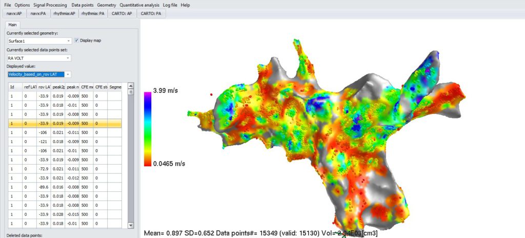
3. Calculate WPV map. Select menu: “Signal processing->Calculate Wavefront Propagation Velocity (WPV) map”. Result WPV map for the LAT map from above:
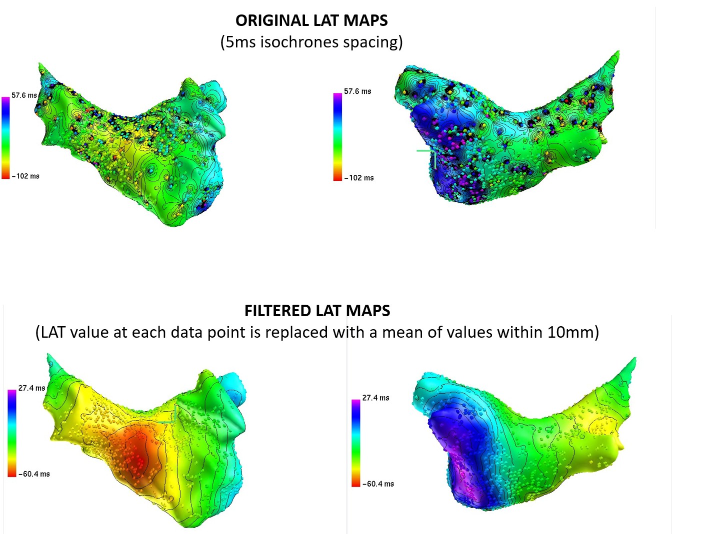
IMPORTANT! Quality of LAT map, is very important in terms of outliers/variability effect on calculated velocity. See example below of the map with isochrone lines. Each outstanding point introduces local isochrones crowding effectively decreasing conduction velocity. So it is very important to clean the maps in the mapping system before exporting. In addition map spatial filtering is possible decreasing effect of outliers. This filtering replaces value or each data point with an average value of all data points in specified range (default range: 10 mm). This step will remove outliers and make map more uniform. It is useful in case of very high density maps. However, if you expect to have small, local conduction blocks, do not perform smoothing as it will erase them.